

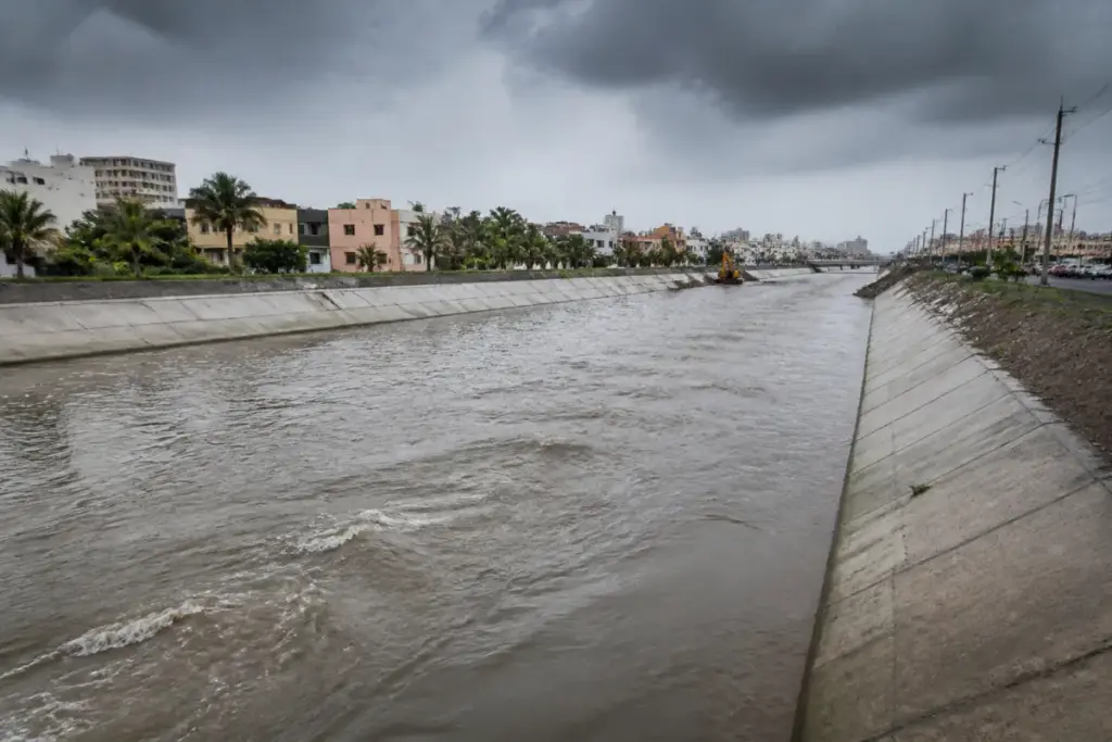
The Okkiyam Maduvu project is nearing completion as Chennai attempts to address a recurring flood problem across Velachery, Pallikaranai, Perumbakkam and other low-lying areas in the southern suburbs. The project is presented as a major intervention, but its significance lies in the drainage system it is expected to strengthen: a chain of water flows from residential neighbourhoods to the Pallikaranai marshland, through the Okkiyam Maduvu and Buckingham canal, and ultimately towards the sea.
The project is only 2.65 km long, yet it occupies a critical position in this larger network. Rainwater from Velachery, Pallikaranai and Perumbakkam usually moves towards the Okkiyam Maduvu before entering the Buckingham canal. From there, the flow continues towards Muttukadu and the Kovalam estuary, where it drains into the sea. This makes the channel less a standalone drain than a link between urban catchments, wetland areas, canals and coastal outlets.
That interdependence explains why flooding in south Chennai has remained difficult to resolve through isolated road-level or neighbourhood-level works. When heavy rain falls, water entering residential areas has forced residents to leave their homes or seek rescue by boat, according to the report. Some residents park their cars on nearby flyovers during floods to prevent them from being damaged. Household goods are also lost when floodwater enters homes. The recurring nature of these disruptions has led residents to demand a permanent solution rather than temporary relief during each monsoon.
The drainage challenge is intensified by the geography of the receiving system. During the rainy season, the sea level rises and water moves into the sea more slowly. That reduces the speed at which water can leave the urban drainage network, prolonging flooding upstream. The Okkiyam Maduvu project is therefore being designed around faster movement of water through the channel, while also attempting to reduce the backflow that affects Madipakkam and Ram Nagar.
The reported intervention combines channel expansion, desilting, flood protection and additional land use. The restoration has a budget of Rs. 27 crore. In the Sholinganallur zone, the active water opening is being widened from 10 metres to 98 metres to enable a smoother and faster flow into the Buckingham canal. The Water Resources Department also plans to remove more than 2 lakh cubic metres of silt and deepen critical stretches by 2 metres. A flood-retaining wall extending 520 metres is planned to reduce flooding in areas including Kannagi Nagar.
These figures indicate that the project is addressing capacity at several points rather than relying on a single excavation. A channel can carry more water only if its entrance, bed, banks and downstream connections work together. Widening the active opening may improve the transfer of water into the Buckingham canal, while desilting and deepening are intended to create more carrying capacity within critical stretches. The retaining wall addresses a different problem: preventing water from spreading into nearby settlements when the channel system is under pressure.
The 2024 condition of the Okkiyam Maduvu also illustrates how maintenance affects the performance of urban drainage. The channel was covered with water plants that blocked the flow, according to the report. Ministers and officials who inspected the site concluded that expansion would be a major solution for flooding in south Chennai and its suburbs. This links the project’s physical works to a wider administrative question: flood protection depends not only on building or widening channels, but also on keeping them clear and maintaining their connections to the broader water network.
The project also requires the government to manage the relationship between public drainage infrastructure and privately held land. The government has decided to dig a channel through patta land owned by a private college near the water body. The report says proper compensation or alternative land will be provided to the owner. This is a significant implementation detail because the drainage route cannot be expanded solely within existing public corridors. Land acquisition, compensation and coordination with private owners become part of the flood-management system when urbanisation has narrowed or interrupted natural water pathways.
The areas expected to benefit extend beyond the immediate Okkiyam Maduvu corridor. The report identifies Perungudi, Thoraipakkam, Semmencherry and low-lying areas along the Old Mahabalipuram Road as potential beneficiaries. It also states that the channel will take floodwater from Perungudi, Semmencherry and areas along the Old Mahabalipuram Road before passing between the Old Mahabalipuram Road and East Coast Road. The drain is expected to enter the sea near VGP Universal Kingdom at Injambakkam.
This geography matters because south Chennai has developed as a connected urban region rather than as a set of separate settlements. Residential areas, employment corridors, institutional campuses and expanding suburban development share the same drainage landscape. Water generated in one locality can affect another when channels are blocked, undersized or unable to discharge quickly. The locations named in the project’s expected benefit zone therefore show the scale of the problem: the intervention is intended to support an urban corridor that extends from inland neighbourhoods towards the coast.
At the same time, the available project details do not establish that flooding will be eliminated. The report describes the project as nearing completion and identifies its planned or ongoing components, but it does not provide a completion date, post-monsoon performance data or an assessment of how the expanded system will perform during rainfall of different intensities. It also does not quantify the drainage capacity before and after the works. Those gaps are important when evaluating a project whose effectiveness depends on the performance of the entire chain from local streets to the coastal outlet.
The role of the Pallikaranai marshland is also central to understanding the intervention. The Okkiyam Maduvu links the marshland to the Buckingham canal, placing the wetland within the city’s flood-drainage geography. The report does not provide measurements of the marshland’s storage capacity or explain how the project will affect its water levels. It does, however, make clear that the channel is part of a system in which water must move through several connected environments before reaching the sea. Any blockage or restriction along that route can influence conditions in the residential areas upstream.
The institutional framework described in the report involves ministers, officials and the Water Resources Department. Their responsibilities include inspecting the channel, approving expansion, widening the water opening, removing silt, constructing a retaining wall and arranging compensation or alternative land for the private land required for the channel. The project therefore combines engineering decisions with administrative coordination and property management. Its outcome will depend on whether these elements are delivered as one functioning system.
The Rs. 27 crore budget provides a defined financial scale for the reported works, but the source does not break down spending between widening, desilting, deepening, retaining walls, land arrangements or other components. Nor does it state whether ongoing maintenance costs have been separately provided for. That distinction matters because the 2024 blockage by water plants shows that maintenance is not an incidental concern. Infrastructure that loses capacity after construction can reproduce the same flood exposure even when its original design is sound.
The project’s larger urban question is how Chennai can protect built-up neighbourhoods that occupy a landscape shaped by marshes, canals, estuaries and coastal water levels. The flooding described in the report is not only a consequence of rain falling on individual streets. It is connected to the ability of a regional drainage network to receive, convey and discharge water under difficult monsoon and tidal conditions. The Okkiyam Maduvu project responds to that challenge by enlarging a key link and strengthening selected sections of the system.
What the project confirms is the importance of network-scale flood planning. The immediate works include a wider opening, deeper stretches, large-scale desilting, a retaining wall and a new channel through private land. What remains to be established is how these changes will perform together once completed, particularly when the sea level is high and downstream discharge slows. The next milestones are the completion of the reported works, the implementation of the land arrangement and the system’s performance during subsequent heavy rains.


