

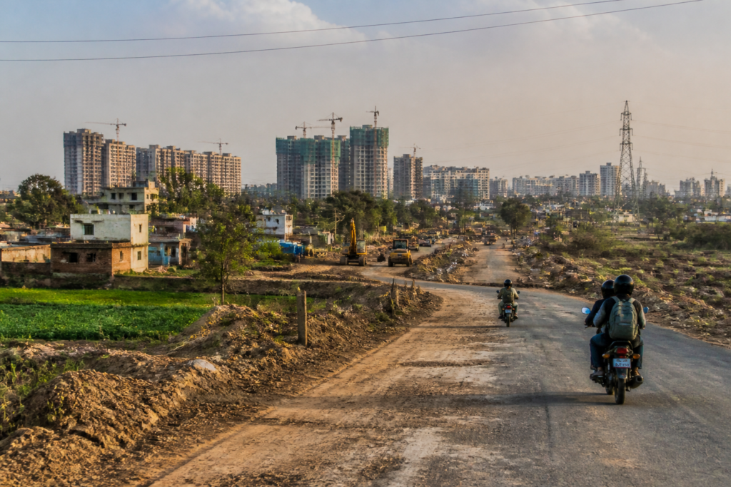
Delhi’s land pooling policy is moving from a planning framework towards implementation, with the Delhi Development Authority (DDA) beginning meetings with villagers, landowners, farmers and other local stakeholders across several planning zones. The stated objective is to enable the development of 12 lakh new homes across roughly 200 square kilometres, alongside roads, utilities, schools, healthcare facilities, parks and commercial centres.
The scale of the proposal makes it more than a housing announcement. It is a test of whether Delhi can convert fragmented peri-urban land into serviced neighbourhoods without separating housing delivery from transport, utilities, livelihoods and local participation. The report published by Live Hindustan – NCR says the DDA has begun forming associations in sectors covered by the policy and is holding structured consultations with affected communities.
Land pooling is intended to change how urban expansion is assembled. Instead of the public authority acquiring every parcel individually, landowners contribute land to a planned development process. The land is then reorganised into a layout that can accommodate roads, public facilities, utilities, residential areas and commercial activity. The specific distribution and implementation arrangements are not detailed in the supplied report, but the policy’s practical challenge is clear: land must be brought together at a scale large enough to create complete urban districts rather than isolated housing enclaves.
That distinction matters in Delhi’s outer areas, where new construction can increase pressure on roads, water networks, drainage, schools and healthcare facilities. A large number of homes, by itself, does not create a functioning neighbourhood. The DDA’s stated plan includes integrated residential areas with roads, utilities, schools, health facilities, parks, business centres and other public amenities. Whether those components are delivered together will determine whether the expansion operates as planned urbanisation or as a series of disconnected developments.
The proposed geography is extensive. The report identifies planning zones in different parts of Delhi, including K-1 around Dwarka and Vasant Kunj, L around Dwarka and Najafgarh, N and P-2 around Narela, Bawana and Kanjhawala, and J around Ghitorni in south Delhi. Villages named in the coverage include Akbarpur Majra, Baprola, Bawana, Burari, Dhulsiras, Gheora, Ibrahim Pur, Jharoda Majra, Najafgarh and Nangli Poona.
This spread gives the programme a metropolitan character, but it also increases the administrative complexity. These areas do not have identical land markets, settlement patterns or infrastructure conditions. Some are linked to established urban districts, while others sit at Delhi’s rural and metropolitan edges. A common planning framework may provide consistency, but implementation will still depend on local land records, existing settlements, road access, utility capacity and the willingness of landowners and communities to participate.
The DDA’s consultations are therefore not a peripheral step. They are central to the land pooling process. The authority has begun meetings with rural residents, stakeholders, landowners, farmers and local communities, according to the report. Such engagement is necessary because land pooling changes the value and future use of land. It also affects people whose economic activity, homes or access routes may already be tied to the existing settlement pattern.
The supplied report does not provide details of the number of participating landowners, the status of individual sectors, the structure of compensation or land returns, or the schedule for completing each development. It also does not specify when the 12 lakh homes will be delivered. Those omissions are important because the headline capacity of a plan and the number of homes actually completed can differ substantially when land assembly, approvals, infrastructure construction and market delivery take place over several stages.
The planned road network illustrates the infrastructure challenge. The DDA is reported to be planning about 600 kilometres of roads around the zones covered by the policy. Roads will be necessary to connect new sectors to existing parts of Delhi, but their function will go beyond movement. They will determine the shape of development, the location of public facilities and the viability of commercial areas. If transport corridors are delivered before or alongside housing, they can support access to jobs and services. If housing precedes connectivity, residents may become dependent on longer and more costly journeys.
The report also links the land pooling areas with the Urban Extension Road-2, or UER-2. A high-density corridor is planned along this route, with affordable housing, commercial development, logistics, warehousing and employment-related activity. This proposed mix suggests that the DDA is not treating the outer areas only as residential expansion zones. It is also positioning them as locations for economic activity and supply-chain infrastructure.
That combination may help reduce the distance between homes and employment, but the supplied material does not establish how jobs, housing and transport will be coordinated. Logistics and warehousing can generate employment and support city-wide supply systems, while also placing additional demands on roads and creating conflicts with residential uses if they are poorly integrated. The success of the corridor will consequently depend on the final land-use plan, access arrangements and the sequencing of infrastructure—details that are not yet available in the report.
The reference to affordable housing is also significant. Delhi’s housing pressure is not resolved simply by adding units at the metropolitan edge. Affordability depends on land cost, construction cost, tenure arrangements, access to work, transport expenses and the availability of basic services. The report identifies affordable housing as one of the intended uses along the UER-2 corridor, but it does not state the income groups to be served, the pricing framework, the delivery agencies or the share of the proposed 12 lakh homes that would fall into this category.
The institutional structure places the DDA at the centre of the process. The authority is responsible for advancing the land pooling policy, coordinating planning zones and engaging affected communities. At the same time, the eventual neighbourhoods will require coordination across multiple public systems. Roads, water supply, sewerage, drainage, electricity, waste management, schools, healthcare and parks cannot function as separate additions. Their delivery requires clear responsibilities, funding arrangements and completion schedules.
The report provides a broad physical scale—200 square kilometres and 600 kilometres of roads—but not the financial framework for achieving it. There is no information in the supplied material on project costs, funding sources, infrastructure charges, public investment, developer participation or the mechanism for maintaining the new assets after construction. These questions will become increasingly important as the DDA moves from consultations and sector formation to detailed layouts and implementation decisions.
Land pooling also raises a question about the relationship between formal planning and existing communities. The villages listed in the report are not blank spaces awaiting development. They contain existing homes, roads, economic activities and social networks. Planned expansion must therefore address how new sectors will connect to existing settlements and how local residents will participate in, benefit from or be affected by the transformation of surrounding land. The report confirms that meetings have begun, but it does not provide details of the outcomes or unresolved concerns raised by participants.
The proposal’s size makes sequencing particularly important. Developing several planning zones at once could spread administrative capacity and infrastructure investment across a large geography. Conversely, phased development could allow the DDA to establish roads and utilities in priority areas before expanding further. The supplied report does not state whether implementation will follow a common timetable or proceed sector by sector.
What is established is that the DDA has started advancing the process and is engaging stakeholders in the identified zones. What remains unclear is the conversion of that activity into legally settled land arrangements, approved sector plans, financed infrastructure and completed homes. The 12 lakh figure describes the scale of the intended housing expansion, not a confirmed delivery schedule.
For Delhi, the larger urban question is whether peripheral growth can be planned as a complete extension of the city rather than as a housing supply exercise. The proposed inclusion of roads, public facilities, commercial areas, logistics and employment indicates an attempt to address that challenge in an integrated manner. The eventual test will be whether these elements are delivered together, at the required scale and with a clear relationship to existing communities.
The next developments to monitor are the progress of stakeholder consultations, the formation and status of sector associations, detailed plans for the 200 square kilometres covered by the policy, the proposed 600-kilometre road network and the implementation framework for the UER-2 high-density corridor. Until those details emerge, Delhi’s land pooling programme remains a major urban expansion plan in motion, but not yet a quantified construction schedule for 12 lakh completed homes.


