

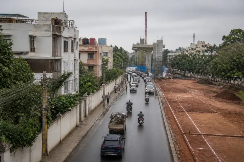
A fresh land-acquisition notification for Bengaluru Metro Phase 3 shows that the project’s most important challenge is no longer only the construction of viaducts and stations. The Karnataka government has identified 170 properties covering 13,409.05 square metres for Package 1, adding another layer to a project already delayed by changes to its double-decker design and facing a possible increase of about 5% over its original estimated cost of Rs 15,611 crore.
The notification covers land required for a viaduct, ramps, pillars, stations and related works between JP Nagar 4th Phase and the Mysuru Road Metro station. The affected areas include Bilekahalli, Sarakki Agrahara, Sarakki, Jaraganhalli, Kadirenahalli, Kareesandra, Katriguppe, Ittamadu, Hosakerehalli and Pantharapalya. The land identified includes parcels connected to proposed stations such as JP Nagar, Dwarakanagar, Hosakerehalli, Kadirenahalli and Kamakya.
Reported by Vijay Karnataka, the notification is the third land-acquisition notification issued for this corridor. That detail is significant because it places land assembly at the centre of the project’s delivery sequence. A metro corridor cannot move from approval to construction simply through a route announcement. The implementing agency must establish the exact land needed for each structure, secure legal control over that land, address affected properties and remove physical obstructions before civil contracts can progress without interruption.
The latest notification also places restrictions on the affected properties. Until permission is obtained from the special land-acquisition officer, owners cannot sell, lease or exchange the properties. The notification states that agreements entered into without the required permission will not be considered while determining compensation. Through the notification, the state is therefore not merely identifying land; it is also freezing transactions that could complicate the acquisition and compensation process.
The scale of land requirements has expanded beyond the 170 properties listed in the latest notification. Earlier, the Bangalore Metro Rail Corporation had identified buildings and properties spread across about 1.33 lakh square metres for complete or partial demolition for Phase 3. A consultancy costing Rs 5.4 crore was also engaged to study land requirements and buildings obstructing work across three construction packages. The structures identified in that earlier exercise included 342 buildings between Hosahalli and Kadabagere, 339 between Mysuru Road station and Kottigepalya, and 406 between Sumanahalli and Kempapura.
These figures should not be read as a single list of properties that will all be acquired or demolished at the same time. They point instead to the physical complexity of building a long urban rail corridor through a developed city. Land may be needed for permanent structures, temporary access, ramps, station approaches, utility adjustments and construction logistics. Buildings may be affected fully or partially, while the latest notification records a more specific set of properties required for Package 1. The distinction matters because the administrative and financial obligations are different for acquisition, demolition, relocation and compensation.
Phase 3, known as the Orange Line, comprises two corridors: JP Nagar to Kempapura and Kadabagere to Hosahalli. The supplied report states that the Union government approved the project two years earlier, but that work was delayed while approval was considered for a double-decker alignment. The original proposal involved a 37-kilometre double-decker structure. The revised approach is to build a double-decker arrangement only where necessary, covering about 11 kilometres.
That design change illustrates how an engineering decision can become an administrative and financial issue. A double-decker corridor can combine transport infrastructure within a constrained urban right of way, but it also requires decisions on alignment, station design, structural systems, land parcels and construction sequencing. When the design changes after approval, land plans and cost estimates may need to be revisited. In Bengaluru’s case, the change appears to have affected the timing of land acquisition and the start of tenders, according to the report.
The cost implication is also tied to time. The report cites transport experts as saying that the original estimated cost of Rs 15,611 crore could rise by about 5% because of the delay. The supplied material does not provide a revised official project estimate, so the possible increase should be understood as an attributed assessment rather than a confirmed new budget. Even a percentage-based rise, however, can represent a substantial additional obligation on a project of this size. It can affect the funding requirement, contract planning and the financial exposure associated with land and construction delays.
The institutional structure behind the notification adds another layer to the project. Land acquisition is being carried out through the Karnataka Industrial Areas Development Board, while the metro corporation is responsible for identifying construction requirements and delivering the rail infrastructure. This division of responsibility is common in large infrastructure projects, but it creates a need for close coordination. The land agency must complete statutory processes and compensation-related work; the metro agency must translate the acquired land into a construction-ready corridor; and tendering must be timed so that contracts can begin when access is available.
The notification’s restriction on property transactions shows why this coordination matters to residents and owners. For affected property holders, the process involves more than a line on a project map. It can limit the ability to sell, lease or otherwise deal with property while the acquisition process is under way. The final effect on each owner will depend on the property’s status, the portion required, the applicable compensation process and the authority’s determination. The supplied report does not provide a property-wise compensation schedule or a completion date for individual cases.
For commuters, the immediate consequence of the delay is that the planned benefits of Phase 3 remain tied to administrative progress rather than only to physical construction capacity. The corridor is intended to extend Bengaluru’s rail network across major parts of south-western and western Bengaluru, but the report does not provide an opening date. It also does not establish when all land required for the two corridors will be secured. That uncertainty is important because the latest notification relates specifically to Package 1, not necessarily to every land parcel required for the entire Phase 3 system.
The sequence now being advocated by transport experts is straightforward: complete land acquisition, invite tenders and begin construction quickly, while setting intermediate targets for delivery. Their argument, as reported, is that further delay could increase the financial burden. But the evidence also shows that speed cannot be measured only by the date on which a tender is issued. A tender awarded before the required land is available can create access disputes, fragmented work fronts and contract-management problems. Conversely, acquisition without a clear construction sequence can leave affected properties in prolonged uncertainty.
Bengaluru Metro Phase 3 therefore presents a broader urban governance question: how should major transport projects manage changing designs, land constraints and public costs without allowing each decision to restart the project’s administrative clock? The latest notification is a concrete step towards securing land for Package 1, but it also confirms that the project remains in a preparatory phase in important locations. The difference between approval and delivery is being defined by property-level execution.
The available evidence confirms three pressures: the project has required repeated land notifications, its double-decker design has been scaled back from the proposed full 37 kilometres to about 11 kilometres, and experts cited by the source expect the original cost to rise by around 5% because of delay. What remains unclear from the supplied material is the final revised cost, the compensation timeline for the 170 properties, the tender schedule and the construction start date. Those milestones will determine whether the latest notification becomes a foundation for rapid execution or another stage in a prolonged acquisition process.


