

Mumbai’s groundwater is facing a coastal salinity threat that cannot be measured only by the city’s overall extraction levels. A Central Ground Water Board study has found that nearly 35 per cent of Mumbai’s area is highly vulnerable to seawater intrusion into freshwater aquifers, with saline groundwater recorded in Fort, Shivaji Park in Dadar, Mulund East and Mahim. The finding turns groundwater from a supplementary local resource into a planning concern involving water quality, recharge, borewell regulation and the long-term resilience of the city’s water system.
The assessment is part of the CGWB’s 2025 Aquifer Management Plan, presented earlier this year by the Union Ministry of Jal Shakti’s Department of Water Resources, River Development and Ganga Rejuvenation. It mapped aquifers across 603 square kilometres covering Mumbai city and suburban districts. The plan’s central warning is not that all of Mumbai is facing the same level of groundwater stress. Instead, it shows that risk varies sharply by location, depth and proximity to the coast or creeks.
That distinction matters because citywide averages can conceal localised damage. The CGWB placed groundwater extraction at 46 per cent in Mumbai city district and 26 per cent in the suburban district. These levels are not considered high overall. Yet the report cautioned that apparently moderate extraction does not rule out seawater intrusion in specific areas. Excessive pumping at a local level can reduce freshwater pressure in an aquifer, allowing saline water to move into it even when the broader district-level extraction figure remains within a comparatively safe range.
This is the key institutional challenge exposed by the study: groundwater management cannot rely only on aggregate extraction data. The condition of an aquifer depends on where water is being withdrawn, how deep the wells are, the geology of the area, the presence of the coast or creeks, and whether freshwater pressure is being maintained. A district-level number may describe the general intensity of use, but it cannot by itself establish whether a particular neighbourhood’s groundwater remains usable.
The geography of the risk is uneven. Shallow aquifers along Mumbai’s western and southern coasts were identified as particularly vulnerable to saline intrusion. In the eastern zone, deeper aquifers near creeks face a higher risk. Saline intrusion was observed particularly during the pre-monsoon period, when the replenishing effect of the southwest monsoon has not yet restored groundwater conditions.
The study recorded electrical conductivity levels above 10,000 microsiemens per centimetre in highly saline groundwater zones, including Fort, Mulund East and Shivaji Park. Electrical conductivity is used as an indicator of the concentration of dissolved salts in water. In practical terms, the measure provides a way to identify areas where groundwater quality has deteriorated because of salinity. The presence of highly saline groundwater at shallow depths in Shivaji Park is especially significant because it has led the report to recommend a complete prohibition on groundwater development there.
The CGWB has recommended different controls for different risk areas. In Fort, it has called for groundwater development to be restricted to depths of up to 60 metres. In Shivaji Park, it has recommended that groundwater development be completely prohibited. These are not citywide restrictions; they are location-specific responses based on the reported condition of the aquifers. Their significance lies in recognising that a single regulatory approach for Mumbai’s wells and borewells would not reflect the city’s varied hydrogeological conditions.
The report also recommends that new deep borewells tapping fractured rock zones should be permitted only after detailed hydrogeological and geophysical investigations. This places greater importance on the approval process before drilling begins. The question is not simply whether a site has access to groundwater, but whether extracting it could disturb the balance between freshwater and saline water in the surrounding aquifer.
Mumbai’s dependence on surface water makes the groundwater issue easy to overlook. The city primarily receives its drinking water from seven surface water reservoirs, which are replenished by the southwest monsoon between June and September. Groundwater, once drawn from wells and other local sources, is now largely used to supplement the city’s supply. That does not make groundwater unimportant. Supplementary sources can become critical for particular buildings, institutions, local users or periods when the main system is under pressure.
The distinction between the city’s main water supply and its groundwater reserves also creates a governance risk. A resource that is not the primary source of municipal drinking water may receive less attention in everyday infrastructure planning. But once groundwater quality is degraded by salinity, the loss may be difficult to reverse at the local level. The CGWB’s warning that freshwater aquifers could become unusable makes the issue one of resource protection, not merely additional supply.
The plan’s proposed response combines recharge, monitoring and tighter controls on extraction. It calls for recharge structures such as recharge pits with filters, recharge shafts and percolation tanks or ponds, particularly in parks and gardens in vulnerable areas. These structures are intended to replenish freshwater aquifers and maintain the pressure needed to resist the movement of saline water.
Recharge, however, is presented in the study as part of a broader management system rather than a standalone solution. If recharge is not directed to the right locations, or if extraction continues to reduce freshwater pressure, the presence of a recharge structure alone may not protect an aquifer. The report’s recommendations connect physical interventions with monitoring and permissions: recharge where vulnerability is high, measure electrical conductivity in coastal observation wells, and investigate the subsurface before allowing new deep borewells.
The recommendation for regular electrical conductivity monitoring is particularly important because salinity can vary by season and location. The study observed saline intrusion particularly during the pre-monsoon period. This means that a single water sample or a one-time assessment may not fully capture the condition of an aquifer. Monitoring coastal observation wells can provide a continuing record of changes and help authorities identify deterioration before groundwater becomes unusable.
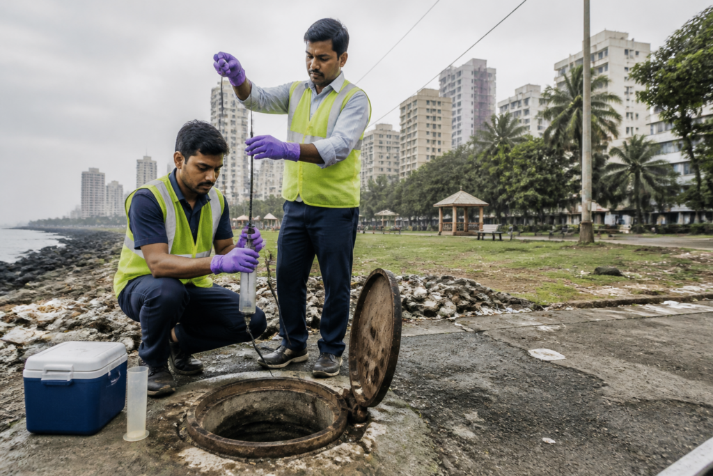
The Brihanmumbai Municipal Corporation has commissioned the All India Institute of Local Self Government to study salinity levels in Mumbai’s groundwater. The agency will collect water samples from wells across the city to assess the extent of salinisation. This municipal exercise could provide a more detailed picture of how the CGWB’s mapped vulnerabilities correspond to current conditions in individual locations.
The BMC study also illustrates the division of responsibilities in Mumbai’s water governance. The CGWB has produced the aquifer assessment and recommendations at the national level, while the municipal corporation is commissioning local sampling and assessment. The next stage will depend on how these findings are connected: whether sampling is used to refine local controls, guide recharge investments, and inform decisions on wells and borewells in vulnerable areas.
The evidence currently establishes three separate but connected facts. First, nearly 35 per cent of Mumbai’s area is highly vulnerable to seawater intrusion. Second, saline groundwater has already been encountered in identified parts of the city, with electrical conductivity above 10,000 microsiemens per centimetre in some highly saline zones. Third, the overall extraction levels reported for the city and suburbs do not eliminate the possibility of localised intrusion. Together, these findings show why groundwater policy must work at the aquifer and neighbourhood scale rather than through citywide averages alone.
The study does not establish that Mumbai’s entire groundwater resource is contaminated, nor does it suggest that the city’s main reservoir-based supply has been replaced by groundwater. Its warning is more specific: vulnerable freshwater aquifers can be damaged by localised pumping and saline movement, including in areas where overall extraction appears safe. That distinction should remain central as authorities interpret the findings.
The larger urban question is how Mumbai manages an invisible resource beneath a densely built coastal city. Groundwater is rarely visible in the same way as a pipeline, reservoir or road. Yet its condition is shaped by land use, well construction, pumping practices, rainfall, coastal geography and municipal regulation. Protecting it requires authorities to connect hydrogeological evidence with decisions made at the level of neighbourhoods, parks, gardens, buildings and individual borewells.
For now, the CGWB plan provides the risk map and the BMC’s commissioned sampling is intended to assess the extent of salinisation across the city. The developments to monitor are the results of that sampling, the implementation of restrictions in Fort and Shivaji Park, the regulation of new deep borewells, and whether recharge and electrical conductivity monitoring are established in the vulnerable areas identified by the study.


